Saturday, December 11, 2010

Parading Down the Street

Day 2 in Oklahoma started much like the end of day one; riding the road. Today we didn't have a battlefield to hike through and spent the entire day with CJ. Though Oklahoma does have a lack of National Parks, it is probably the best state to experience Route 66 in. Every small

town we passed through seemed to embrace the road and each one had a small little niche that makes it easy to pull over and experience. After a morning of sipping the Sioux City Sarsaparilla we picked up from Pops, we pulled into the town of Stroud in the heart of Oklahoma's wine country. Since it was still early and none of the wineries were open yet, we decided to have some breakfast at the Rock Cafe. Diners on Route 66 have not yet let us down, and this place was no exception. The food was amazing and

cheap to boot. I ordered 2 pancakes, (which turned out to be an inch thick and the size of my head) a side of bacon, and a large orange juice and paid only 5 bucks. Both Katie and I ate for under $15 including tip

and neither of us could finish our meals. The Rock Cafe is home to another Cars inspiration. This time its the character of Sally was directly inspired by the owner and cook of this little gem. After breakfast we headed back 1 mile, clear across town, to the Stable Ridge winery. Like many times before, we were the only people visiting the winery on this cold December day, and thus got the royal treatment. After we received a free tasting to any wine we desired, the owner came around and gave us a tour of his operation. We talked with him for about 20 minutes as he told us the story of his winery and we shared with him the story of our travels. Afterwards we couldn't help but buy some wine to help us remember this Oklahoman gem. We drove a bit longer and eventually ended up being the final car in a holiday parade. The last three floats became Santa, a cop car, then CJ. As you can imagine, we didn't plan this. Here we are, driving down Route 66, minding our own business when we come across a cop blocking the road. She was rather disgruntled at the time and at first refused to talk to us, standing at a distance and gesturing imploringly for us to turn around. Once she realized we weren't moving, she came over to the car and told us about the parade that was about to begin and how it would be smart for us to turn around. We expressed our need to travel every mile of Route 66 and told her we would be glad to wait until it was over. She agreed and allowed us to follow her in the parade. After watching all the floats go by, Santa finally came and we took our place in line, waving and occasionally honking at the kids who all seemed confused as to whether or not they were supposed to be waving at us. After

about a 1/4 mile of crawling through town, our directions led us off the parade route and we continued down to the Blue Whale. The Blue Whale is now just another roadside attraction but in its hay day it was a full functioning water park. It shut down in the late 80's and is now just another relic of the road. Still the slides, ladders, and diving boards are all along the whale and would have seemed inviting if we had been there in summer. As it was, Santa was sitting in front of the whale and taking pictures with kids for a nominal fee. After visiting the Blue Whale we made a stop at the Nut House across the street. It was obvious to us that this place was a giant tourist trap but

we couldn't help ourselves. We stopped in and enjoyed all of the free samples, again and again, then made a stop at their deli, enjoying some of the best deli sandwiches I have ever had. The rest of the day continued as Route 66 does, driving through small towns and taking pictures of

their murals and other goofy stuff. We did pass a brush fire along the way which was pretty neat to see. All throughout the day we had heard from folks that a storm was coming. Katie and I are disconnected from the news and have to rely on word of mouth to hear things. Luckily weather is one of those topics that someone always brings up at some point in the day. We heard a cold front was coming but didn't see any evidence of it all day. We hoped that we would stay ahead of the storm but after night fell and the temperature dropped, we were pretty sure that it was catching up with us. Right before it began to snow, we crossed into Kansas for the 15 miles of

Route 66 that skirts its southeastern corner. Here the main attraction is their big blue trestle bridges, the highest concentration along Route 66. With Missouri came the snow. By the time we got to Springfield Missouri it was evident that we couldn't stay the night in the van. We pulled into a few motels looking for a Route 66 classic only to find creepy surroundings that looked like they had hourly as well as monthly rates. Finally we decided to go to the Radison down the street and just cut our losses. The wind was so strong and the weather so cold that one huge gust stalled out CJ as we were pulling into the parking lot. We spent the night warm inside yet our hearts were heavy, fearing that in the morning we would be calling a tow truck rather than continuing down the mother road.

Friday, December 10, 2010

Come on Okies!!!

We woke up in Oklahoma quite cold. As Route 66 slowly crept north the temperature as well as our sleeping arrangement became less and less desirable. Though still tolerable in Oklahoma, we could sense that soon we would be needing to hightail it to some place where we could stay indoors. The rest stop that we stayed at the previous night also happened to be the Oklahoma welcome center, which worked out really well for us. After preparing for the morning in our separate rest rooms, we converged in the welcome center and rifled through all the attractions that we could potentially see in Oklahoma. The best find at the welcome center was an Oklahoma Route 66 map and guidebook which replaced all of our other handbooks for our stay in the state. When we finally got on the road we had to backtrack a bit to the little hamlet of

Erick Oklahoma, which we unfortunately had to pass over on our flight from Texas the night before. Here, according to our books, was an old curiosity shop called the Sand Hills Curiosity Shop which aside from having a lot of fun stuff to look at, also is home to a group of bluegrass musicians who follow you around the shop playing music. The owner of the shop was also the inspiration for one of the characters from the Disney movie Cars. Sadly as we pulled up to the store it was as empty as

the town. We still aren't sure if it was just closed for the season or if we had arrived to early for the music to begin playing, but either way we were out of luck. Deciding that we should spend a couple hours off Route 66 and give her some time to wake up, we headed north. Our destination was the Washita Battlefield NHS, Oklahoma's only National Park Site. The word battlefield is sort of a misnomer in this case, massacre would have been nearer the mark. Here, under the leadership of General George Custer, the US Army attacked and killed a tribe of women and children which Custer mistook for a war party. Being the only visitors at the site we got the grand tour by the lonely park ranger, watched the informational movie, and did the interpretive trail around the battlefield itself. Aside from the subject matter, our visit was a lot of fun. It was the first time in a few days where we actually got out of the van and hiked for a

couple miles; needless to say it felt great. After the battlefield we headed back to Route 66, passing through small towns and stopping at the occasional diner as recommended by our guidebooks. Along the way, during one of the sections of open country, we spotted an

armadillo next to the side of the road. Katie was ecstatic! She had never before seen an armadillo so I turned around and she got and snapped some photos while creeping ever closer until she finally got creeped out herself and ran back to the car. We continued driving until nightfall. Outside of Oklahoma City we used some of the info packets we picked up to try and locate a brewery but we were unsuccessful. We found a couple but they both turned out to be just warehouses without any restaurant so we decided to get our fill for the night on peanut butter. Back on Route 66, the neon was now in full swing. It's interesting to think about how different some places must be during the night as opposed to the day. Our next stop, Pops, is a perfect example of this. Like many Route 66 attractions, Pops is covered in neon lights. During the day, the giant pop bottle that sits outside the diner must seem odd and boring in its all white shell.

At night however, it is a beacon seen for miles away as you ride along in the still night. Its neon lights flow up and down the bottle, pulsing and flowing as though it were alive. We have actually had lots of luck passing by the spots which are known for having great neon displays at night, but Pops is definitely a must to see after dark. Pops is an odd place. First off, it was not around during the years of the actual Route 66 and only came to life as part of the roads revival effort. It has won many awards for this, being a new addition to Route 66 yet fitting in so well. The place was packed wall to wall and had we planned on eating there it would have been a 45 minute wait. As it stood, we were just there to pick up some pop. They have over 300 different bottles of pop so we went to town raiding the fridge. We left with two 6 packs of soda and one of beer, appropriately named "Pops." About a mile down the road we came across another iconic Oklahoma Route 66 attraction, the round barn. The round barn represents the opposite side of the coin when it comes to night time travel along Route 66. Since this attraction has been around since the 20's, there is no neon gracing its sides and passing it in the dark, we almost drove right by. There was a private party being held there that night so we merely walked up to the front, were denied entry, then turned around. After that we headed south to pick up the interstate and settled down in a rest area for the last time on the first part of our trip.


Thursday, December 9, 2010

Deep in the Heart of Texas

The morning was spent as a pretty standard Route 66 morning. We drove through numerous

towns full of teepee curios and roadside diners, stopping at most of them, if only to look around. We chose Joseph's Diner for our meal because they were well known for having great biscuits for breakfast. After our meal we passed into Texas, excited to spend the day in the Lone Star State. Here in a town

called Adrian, we reached the famed Midpoint Cafe, located at

the direct midpoint of Route 66: 1139 miles to both Los Angeles and Chicago. We had hoped to have lunch here but the Midpoint Cafe seemingly did not possess the draw that the owners had intended and had gone under years ago. This small setback in the plan though

not necessarily a disappointment, would begin our slow downward spiral in luck for the day. One of

the major attractions we wanted to see in Texas was next on our list of Route 66 stops: the Cadillac Ranch. The Cadillac Ranch consists of 10 Cadillac's lined up in a straight line and buried nose deep in the middle of a corn field at the exact angle of the Great Pyramids in Giza. Yearly they are painted a base color of white or blue and then within days are covered in spray paint by the locals. Guided by my wayward navigator, we drove around unable to find

the Ranch for about 15 minutes before we stumbled upon a large truck bearing the words "theDonut Stop." Katie made me pull over the car immediately to take a picture. Apparently one of her friends had passed by this exact location a few years ago while looking for the Cadillac Ranch as well. Katie spent the next 10

minutes talking to him on the phone while I took the time to read the directions myself and got us there in 5. When we arrived we were the only ones out in the field. The sculpture has been moved from its original location and is right next to the highway now

only accessible by a service road. For all the traffic in the area, you still feel alone out there. Right as we approached the cars themselves we noticed a veritable graveyard of used spray paint cans littering the trail before us. We walked around for a bit messing with the cars, spinning tires or peaking in to see what was left inside. I found a spray paint can that still

had some juice in it and left our mark on the side of one of the Cadillac's. After hastily spraying "R + K" and taking pictures from a few different angles, we were ready to go. In Amarillo, we noticed that there wasn't much to do and we were torn about whether to continue driving the day away or to try and find something to do in the area, hopefully stretching our legs for a bit. We decided on the latter and headed north of Amarillo to try and visit the Alibates Flint Quarries National Monument. It was a little less than an hour away and when we arrived there at 3 p.m. the rangers were already leaving for the day. We stopped and talked to them for a minute and they told us that they are only open by appointment, they had only had 2 visitors that day, and they never stayed open past 3 p.m. We were given the option to come back the next day and they would take us on a tour to the site of the quarries but we told them we were just passing

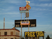
through and would not be able to partake. Our northern excursion failed we decided to head back to the city and eat dinner at the famed Big Texan restaurant. We have been aware of this place for days. In Wall Drug like fashion it has signs and billboards littering the roadside as far away as Flagstaff Az. Their

big attraction is the "FREE 72 OZ. STEAK" you can receive there if you can put it down in under 1 hour. Sadly there were no takers while we were at the Big Texan. We would have known immediately because they had a big elevated table in the center of the restaurant with digital clocks above each seat. The food was not nearly as good as the atmosphere but we still had fun and were glad that we got to see what all the hype was about. It was just about dark by the time we left the Big Texan and we decided to stay in Amarillo and visit a Starbucks for a couple hours before continuing down Route 66. We sat down and noticed the problem immediately. My computers charger had definitely seen better days and it seemed that finally its end had come. Without a charger my laptop was worthless since the battery was already about empty. Seeing no other option we headed to Best Buy and bought a $100 replacement. To add to our frustration we went to another Starbucks that did not have any outlets and we were forced to retreat back to the original. After about an hour neither Katie nor I were getting anything done and we thought that our time would be better spent driving.

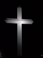
The night was truly dark now as we began to wind through the Texas back country without a street light for miles around. All of a sudden looming out in the distance we began to approach what we would find out to be the worlds largest cross. We drove up close to it and craned or necks to the sky and looked in awe of this enormous shining beacon. Our spirits somewhat uplifted from our stressful day of disappointment and inactivity we continued on into the night not knowing what sign would cross our paths next. At a speed of about 60 mph we drove through the darkness over a hill to be greeted by a small herd of deer in the middle of the road. I slammed on the brakes and swerved to the right but there was nothing for it, we were about to have impact. Instead of staying where they were, the deer decided to try and cross the road in front of me but they weren't quick enough. Amid our screams of panic, there was a loud thud as we hit the second deer with the side of our van. We continued down the road, both Katie and I in a slight state of shock. We didn't know what to do. Katie wanted to stop immediately and check on CJ, but she was running fine and I did not want to have to face a suffering animal in the middle of the road. We drove a couple miles in the darkness until we reached a lone street lamp near and intersection which we decided to stop at. Still on edge, I went to open my door and discovered it was jammed shut. Wrenching it open, I was happy to discover the damage wasn't that bad. We looked and aside from a small, well placed dent on the side, the van was virtually untouched. We began to become hopeful, thinking that the deer may have just slammed into our side and was perhaps unharmed. We decided to go back and check on the deers status hoping to either find him gone or else completely dead in the road. The worst thing in my mind would to be for it to be struggling for life in the middle of the road. Then I would have to slit it's throat or kill it with my hatchet, both options that I hoped I didn't have to face. We again drove into the darkness, this time driving extra slow since our nerves were on edge and we weren't sure if the rest of the herd had left the area or not. We were getting nearer to the site and our anticipation was building when all of a sudden a cat jumped into the middle of the road and was flattened by a loud "pop" underneath our tire. Katie and I couldn't believe it. We were in utter shock. We began to laugh. The desperate crazed laugh of someone trying to do the right thing but, doomed by fate, only inflicts further hurt on the world. There was no need to stop or turn around for this animal, it would be nothing but a flattened pile of blood and guts. Our hysterical laughter continued until we reached the site of our first victim. Faced with our misfortune, the laughter stopped altogether. The deer was dead... thankfully. It was in the center of the road, blood pooled near its head. Upon further inspection of the van, we could see small lines and scratches on the front of the van where we must have collided with it head only to swing the body around, thus denting the side. After this we decided that the 20 miles left in Texas of Route 66 were better left untraversed. We hit the highway and got the hell out of Texas, bedding down in Oklahoma where we had a clean slate and hoped to start a new day in the morning, with this awful day of misfortunes behind us.
Wednesday, December 8, 2010

Alien Caverns

How can anyone say they visited New Mexico without visiting the small town of Roswell? Made famous by the 1947 incident that sparked the modern UFO phenomena, this was a town that we at least, could not pass up. We decided to abandon Route 66 for the day and take a side trip south to see both Roswell and more importantly Carlsbad Caverns National Park. Heading south from the interstate there is nothing for miles and miles except open farmland. Rangeland is perhaps a better word because these farmers

aren't growing anything except herds of cattle seen off in the distance. After driving about 3 hours straight south and passing nothing except one small gas station we pulled into the small town of Roswell. We hadn't really expected to find much here since we had heard from numerous people along our travels that the town was nothing more than a big disappointment. Indeed it

was. The town is filled with very subtle hints regarding their alien visit. The most obvious places heralding the past are ironically the chain stores. The Comfort Inn, KFC, and Arby's all have signs along the lines of "Aliens Welcome" or "Alien Seating Available" and things of that nature. As

always the McDonald's outdid the rest and was by far the most interesting. It had been completely transformed into a UFO complete with a space-themed playset inside. In the center of town there was a UFO Museum and a few local souvenir stores crammed full of everything you can possibly imagine. Here the street lights were even made out of alien heads, donned

appropriately with Santa hats for the holidays. After about an hour of messing around downtown Roswell we headed south for Carlsbad. Even though we began our journey south from the interstate early in the morning we still were not able to reach Carlsbad Caverns until about

2:30 p.m. We thought we were making decent time and planned to spend the rest of the day inside the National Park. We were astonished to find out as we entered the park that the trails and caves started closing at 3 p.m. We hightailed it to the visitor center and found out that we were just in time to get a full tour of the place. We were one of the last people to enter the cave through the natural entrance for the day. The ranger told us that if he could only do

one thing here it would be take this hike, and thats what we did. Because of the time of year that we visited the park, we missed out on one of the main attractions of the park; the bats. Carlsbad Caverns houses an enormous number of bats in a section of the cave known as "the bat cave" where the floor is known to be covered by a 40 ft. layer of guano. The bats fly south to Mexico in

the winter months so we were unable to see their nighttime flight from the cave. Regardless, Carlsbad Caverns was easily the most impressive cave I have ever entered. I could spend hours trying to explain and describe the underground wonders that we saw here. Its mind-boggling to think that it was all formed by the slow drip of water

over millions of years. We walked a total of 3 miles underneath the earth passing by vast caverns, unique structures, and bottomless pits. It was a shock to realize that the sun was still shining after we emerged from the eternal darkness of the underworld. We shopped around the visitor center until the national park closed down. We made a stop in a town called Artesia, half way between Carlsbad and Roswell, for dinner at The Wellhead Brewpub. From here we continued on through the night making it back to the same rest area we stayed at the night before, ready to continue on Route 66 in the morning.

Tuesday, December 7, 2010

New Mexico's National Monuments

Before we left Arizona the next morning we took an excursion to the north to visit the

Hubbell Trading Post. At the time, Katie had been reading a book called Vagabond For Beauty which Megan had given to us back in Park City. It is a biography about Everett Ruess, a young guy from California who gave up all his possessions in order to travel around the country honing his artistic skills while trying to capture natures beauty. Everett eventually went missing in Southern

Utah and no one has yet found his remains, but before tragedy struck this traveler he spent a short while at the Hubbell Trading Post, hence our interest in the site. The Hubbell family has always had a soft spot for artists and still to this day artists are allowed to stay at the trading post for free as long as they want. All that is required of them is to leave one piece of artwork for the families personal collection before they leave. The Hubbell Trading Post was about an hours ride north of Route 66. The structure itself is very small and unassuming. We would have easily missed it had there not been National Park signs all around. The complex hasn't changed since at all over the years, no supplemental buildings have been added and it is still a functioning trading post even today. During our visit in the gift shop, Katie was lucky enough to be asked to join a private tour, so we hopped on the opportunity to see the inside of the Hubbell house. After the tour, we decided we couldn't visit

a trading post without buying some supplies, decided on some herbal tea and salsa, then made our way back to America's Main Street. We crossed into New Mexico, making frequent stops along the way at every teepee shaped Indian store to shop and help break up the long drive. South of Route 66 there were two National Monuments that we wanted to visit. We decided to make the drive south to visit one today then we would drive Route 66

at night then hit up the next one the following day. El Morro National Monument would be todays excursion. El Morro is a large stone monolith that jets out into the valley. There is a pond there, sometimes a waterfall too, that has been a continual water source for centuries. Thus, people have made this a

frequent stop on their journey west. El Morro has been designated a National Monument because after visiting this watering hole, it had become customary to carve your name in the side of the white stone. The native americans started this tradition and it continued for hundreds of years resulting in thousands of names and pictures carved into the rock. The cool part about the site is many of the

later people who carved their names were parts of Calvary units or else famous in some regard and the national park service has been able to trace their history and stories both before and after they came to this site. We arrived on the site with just enough time to do a hike to the top of the stone structure and visit the ancient indian ruins there and do the hike along the base of the structure and see all the engravings. After we left El Morro we headed back to Route 66 enjoying a beautiful sunset along the way. We spotted a badger near the road (our second on this trip) and pulled off for a bit to honk at him trying to get his attention. The only city

that we passed through along Route 66 that night was Gallup NM. This town is famous for being the home of the El Rancho Motel

which in its hay day housed many Hollywood elite's. They showcase this fact by littering their walls with the pictures of all their former A-list guests, all of whom have now faded into obscurity, at least as far as Katie and I were concerned. After walking the inside of the hotel we drove along Route 66 looking for City Hall which had a newly built neon Rt 66 sign. It was far less impressive than fame had reported, and after we snapped a quick photo we drove until we reached our rest stop and bedded down for the evening under the bright New Mexico sky.


The second of our National Monuments that we wanted to visit was called El Malpais National Monument: aka the bad lands. It got this name because it is home to 29 volcanos. They have all three different volcano types at this national monument: shield, composite, and cinder cone. We made our way to the visitor center and talked with the ranger for quite a while. Unfortunately, we weren't able to visit a large majority of park because we had plans that day

to visit Alberquiuqre and Santa Fe that day was well. Still we had some time to explore and decided to make our way to the Land of Fire and Ice, a family owned business that offers a tour of a volcano and an ice cave. When we got there we hiked to the top of the volcano first and walked inside the crater. This was really nothing new for us but walking inside a volcano is always a fun way to start your morning. Next we visited the ice cave and we were both really excited about this. Though the opportunity to see ice inside a cave had been dangled before us many times on our trip, we had yet to see it and we were both excited about the opportunity. The ice cave did not disappoint. Not only was there tons of ice both hanging off the ceiling and walls but also enough on the ground to form a miniature skating rink. While inside the cave Katie and I began to experiment with seeing our breath. Admittedly, this doesn't sound like much fun, but believe me it was. Since there was absolutely no wind in the cave and since the sun was shining at the perfect angle this time of day, you could slowly exhale and watch the moisture flicker and twirl in the sunlight until it faded into nothing. It was honestly one of the most fascinating things I

have ever seen. I could have wasted hours just staring at my own breath, but alas we had to move on and continue our day. We stopped at the WOW Diner back on Route 66 for a quick meal once we got back to the highway. The ranger we had spoken to earlier was a Route 66 fanatic as well as a park ranger and highly recommended this place as a must see. We enjoyed the atmosphere much better than the food but our bellies were full nonetheless and we continued on our journey east. On the way to Albuquerque we passed by Owl Rock and Dead Mans Curve, both renowned Route 66 landmarks and even stopped at another house owned by the Hubbell family. In Albuquerque, we made a quick stop at the Marble Brewery then headed

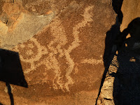
to the outskirts of town to visit Petroglyph National Monument. Again racing against daylight and closing time we only had enough time to do 3 short hikes before we would be kicked out of the park. Luckily at this site the petroglyphs are so concentrated that we were able to visit hundreds of petroglyphs in this small

amount of time. After night fell and the gates closed we had a decision to make. This section of Route 66, like many along the way, has 2 different alignments. Once upon a time the road traveled north to go through Santa Fe, but later on it was realigned to just pass through Albuquerque, avoiding the northward jaunt completely.

Since we had the time, we decided to drive both stretches and get a feel for both cities while we were here. We drove the Albuquerque stretch which was full of neon lights and gaudy signs that moved and flashed in the darkness, then looped back around and headed north to Santa Fe. We were planning on eating dinner at the Santa Fe Brewing Co which was right along the Route 66 alignment. We pulled in and had a beer but there was no restaurant in sight so we didn't stay long. We found another brewery, Second Street Brewery, in the center of town where we finally got to enjoy a late meal before driving back down to the main highway to find a spot to sleep at for the night.

Sunday, December 5, 2010

Have You Slept in a Wigwam Lately???

Today we set out to enjoy the Flagstaff area. Though we had already passed though this area twice now, it has been just that, passing through; now it was time to explore. Via our atlas, we had learned that the area was chalk full

of National Monuments and we made this our charge for the morning. Just north of Flagstaff, east of the San Francisco mountains, and south of the Grand Canyon lies Sunset Crater National Monument and Wupatki National Monument. Sticking to our strict Route 66 path while traveling east, we hopped back on to the Mother Road in downtown Flagstaff and took it for a while until we reached the road that would take us to Sunset Crater NM. This National Monument was named for its rust colored crater that shines particularly red at sunset. It is a dormant volcano, much like the nearby San Francisco Mountain Range, and the evidence of volcanic activity is everywhere. We again drove by the familiar lava beds and spatter cones

which we now associate with a volcanic area. At the visitor center we learned about some hikes that we could do and set off for a couple around the base of the volcano in the lava fields. Here we barely even read the interpretive trail guide that accompanied the hike, again it was all old news to us. Because we visited the park so early in the morning the rust colored top which gave it its name appeared to us a normal

blackened volcanic crater. In the interest of time, we decided to move on and not await the sunset to experience its reddish hue. Our next destination, Wupatki National Monument, was just down the road from Sunset Crater NM. If you can't tell by the name, this

location was another Native American archeological site. There were about 5 or 6 different dwellings along the 23 mile loop trail. In the distance and from lookouts along the way you could see the painted desert stretching for miles around. It was an awesome sight to see the ancient ruins in the blazing sun, set

against the backdrop of the painted desert. We visited 3 different sites walking in and around them, even exploring one intimately with the help of an interpretive guide. Once satisfied with our northward excursion we again traveled south to pick up Rt. 66 heading eastward once more. Along the way we passed the iconic Rt. 66 town of Two Arrows which consisted of a trading post and 2 giant arrows stuck in the ground. Our next stop was at Meteor Crater. Half tourist trap and have amazing oddity of nature, this

place is family owned and in no way associated with the National Park Service; basically meaning our pass didn't work here. Still, because of the many documentaries and science specials I have seen in my day, I really wanted to see this place. We decided to

eat the entrance fee and explore the crater. As fate would have it we were just in time for one of the daily tours that walked along the rim of this massive crater, led by a would be park ranger. The group that he took out was pretty small, besides Katie and me there was only 4 other people, which made for a quick but intimate tour. It turned out that our guide was from Alaska so in between our 2 stops Katie and I got to talk to him and share our adventure and love of the state with him. We learned about the reverse strata effect that helped prove that Meteor Crater was actually formed by a meteorite. Up until the late 60's the scientific consensus was that this crater was like all the others in the area, volcanic. The reversed strata, when the bottom layers of sediment are on the top, helped prove that this was indeed an impact crater. Meteor Crater was even used by the Apollo astronauts to help them prepare for the moon landings, allowing them to identify impact craters on the moon thus giving them a better understanding of the rocks which they collected. As we exited the

visitor center, after our tour and a long browsing of the gift shop, we noticed what appeared to be a picture set against a wall. As we took a closer look we realized that it was actually just a

square hole in the wall perfectly framing the mountains in the distance. Needless to say it was pretty cool. We again headed east on Rt. 66 making our way to Winslow Arizona. This town turned out to be much smaller than we had hoped. We were planning on grabbing

a bite to eat here, but instead we just parked the car, stood on a corner just like Jackson Browne, then continued on down the road. We passed another legendary stop on Rt. 66 miles down the road, again named for a trading post. This town was called Jackrabbit and featured the infamous "Here It Is" sign as

well as a giant jackrabbit which Katie and I both took the time to ride. We passed a few other towns along the way before reaching our destination for the night,

Holbrook Arizona around 4 p.m. This town is famous along Rt. 66 for a couple of reasons. First, it is the gateway to the Petrified Forest National Park and Painted Desert. Second, it is home to 1 of 2 of the remaining Wigwam Motel's along the route. As we pulled into Holbrook,

we stopped in at the Wigwam Motel, curious to find out if you could still stay inside them and how much it would run us for a night. Unfortunately when we pulled in, it was deserted and closed. Old classic cars were parked in front of every wigwam and there was a newly erected sign designating the site as a historic landmark.

This sealed the deal for us and we figured it was now closed permanently. Disappointed, we carried on to the Petrified Forest National Park. As we entered the park we learned that it closed at 5 p.m. on the dot. At 5 p.m. you must be in a car and driving toward an exit; it was crazy.

Luckily, we entered the park on the south side near the Giant Logs Nature Trail. This is the best place to view the petrified logs. After a quick hike we continued down the road and were lucky enough to make 2 more stops at the

Agate Bridge and Crystal Forest before 5 o'clock came around and we were forced to drive to the exit. However, since the painted desert is beautiful during sunset and because you can view everything from the comfort of your vehicle, everything worked out just fine

for us in the end. Once we left the park we headed back to Holbrook to find some dinner. We were roped in by a sign declaring "best food in town" and we were

not disappointed; the food was great. After dinner we didn't really have many plans so we drove through town once more and found to our joy that the Wigwam Motel

was now open! The elderly lady inside told us that they are only open 4 hours a day form 4p.m. to 8p.m. We just missed them earlier in the day and we almost missed them this time around as well. It seemed to us that it was our fate to stay at the Wigwam Hotel for the night. We piled into our teepee and spent the night away from the cold in our warm bed.